DESTINATIONS
MURCHISON FALLS NATIONAL PARK
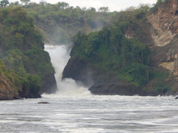
The spectacular oldest National Park in Uganda coverng approximately 3840 square kilometers at an altitude of 127m above sea level along the Albertine Rift Valley. Its iconic falls of the River Nile squeezes through an 8 meter gap and then plunges 45 meters with a thunderous roar.
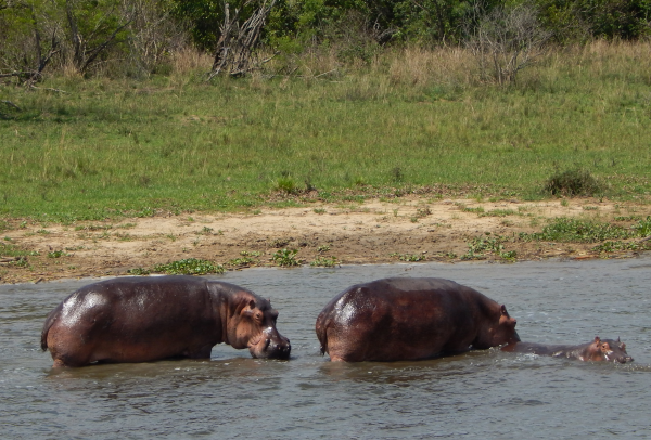
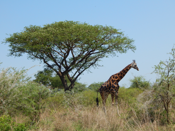
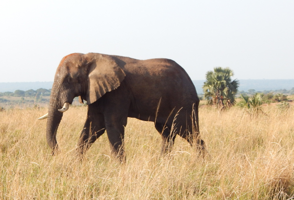
It is also know due to its biodiversity spreading across the Albertine Rift Valley that offers savannah grasslands, acadia woodlands, tropical forests, wetlands that act as a natural habitat to over 556 species of birds, 144 mammals including lions, african elephants, giraffes, buffaloes, hippos, nile corocdiles and rhinos (however rhinos live in isolation at Ziwa rhino sancutary), 52 reptiles and 51 amphibians.
The park is also a magnet for birders with a vast range of bird species, the "shoe bill stalk" as the most common along the Albert Delta, the white crested turaco, the red winged grey warbler among others along the woodland in the southern banks.
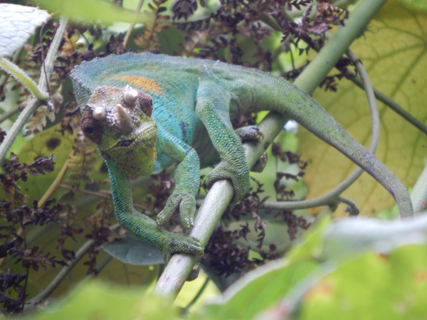
BWINDI IMPENETRABLE NATIONALPARK
Just as the word "impenetrable" depicts, this dense jungle lies in the south west of Uganda covering an area of 321 square kilometers at an altitude of 1160-2607 meters above sea level along the edges of the Rift Valley with a dense canopy covered in mist an is one of Ugandas biologically diversest rain forest that date over 25000 years.
It was established in 1991 an recognized by UNESCO as a national world heritage site. With it's eco friendly and biological diversity it provides natural habitat to 120 species of mammals that include mountain gorillas, chimpanzees, baboons, forest elephants, antelopes. It also provides habitat to 350 species of birds (earning a title of Best birding destination by "Travel Africa Magazine"), 200 species of butterflies, 200 tree species and also a home to 51 reptiles.
Its widely know for its shelter to approximately 459 mountain gorillas estimated to be half of the worlds population with with remainder in Virunga conservation area, shared with Ruanda and the Democratic Republic of Congo.
Historically it has been a home to the indigenous humans know as the "Batwa" (pygimies) that now reside in the adjacent buffer zones. These people lead tours about their jungle life and their old hunting, honey harvesting, hut building, trapping practices, traditional music and dance.
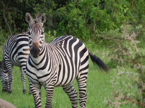
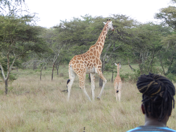
QUEEN ELIZABETH NATIONAL PARK
Also previously know as Kazinga National Park but later renamed in the 1950's in honour of a visit by the british monarch this 2nd largest and most popular conservation area covering 1978 square kilometers at an altitude of 910-1350 meters above sea level spans the equator line where it crosses at latitude 00.
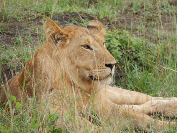
It is notable the most popular tourist destination in Uganda due to its breath taking biodiversity spanning across the Albertine Rift Valley where the Park offers savannah grasslands, acadia woodlands, tropical forests, fertile wetlands, providing a safe haven to over 95 species of mammals (20 carnivores) including climbing lions, spotted hyenas, african leopards, side stripped jackos, hippos, elephants, buffaloes, Uganda jobs anong others. It also acts as a natural home to 600 bird species thus being recognized by "Birding International" as an international birding area. The Park is famous for the climbing lions that perch in the giant fig and acadia trees.
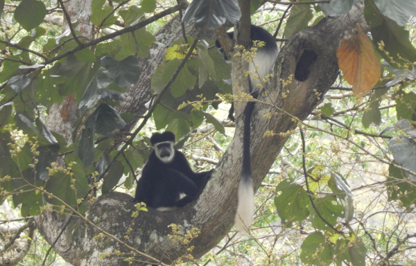
KIBALE NATIONAL PARK
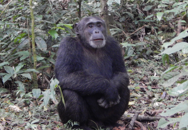
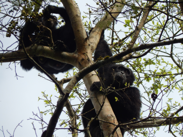
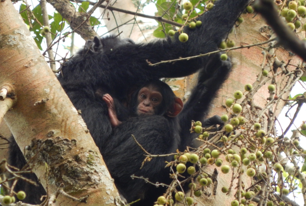
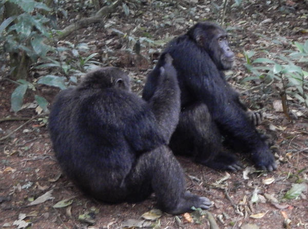
This primate park located in the Western part of Uganda covering 321 square kilometres at an altitude of 1160-2607m above sea level is well known for its chimpanzees and 12 other primate species including baboons, a variety of diurnal monkeys and forest elephants , 370 tree species in low land and montane forests, 50 terrestrial mammals , 350 species of birds. The park offers a natural home to about 1500 chimpanzees population divided in dozens of different communities.
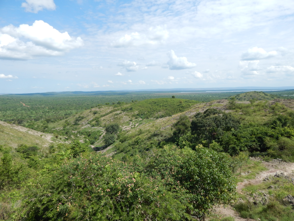
RWENZORI MOUNTAIN NATIONAL PARK
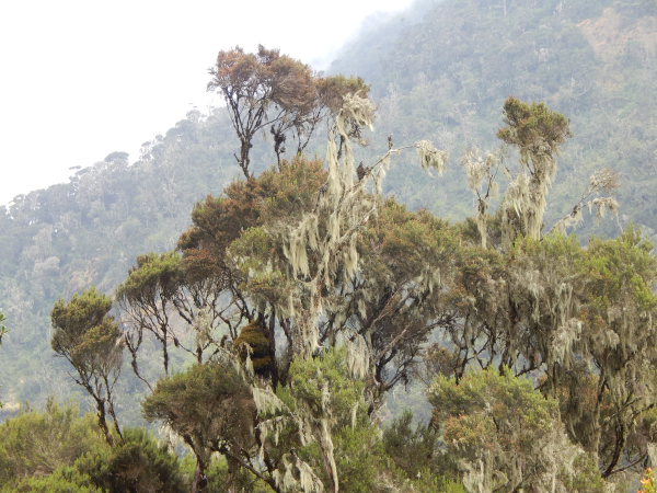
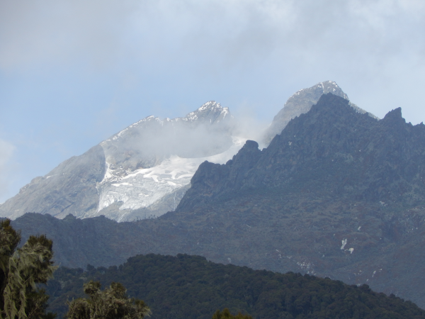
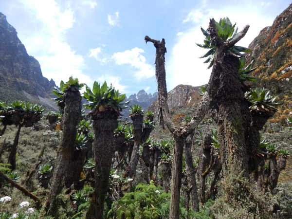
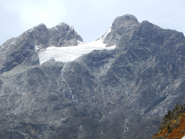
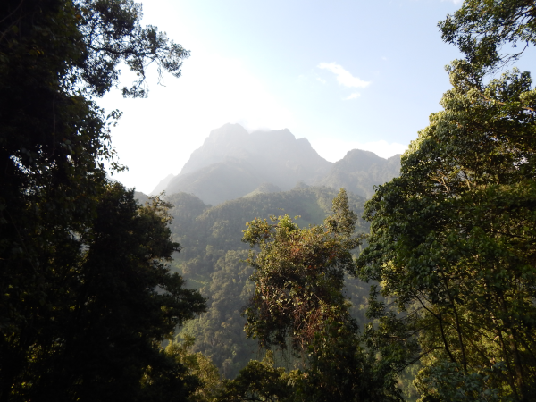
The park lies in the western part of Uganda along the Democratic Republic of Congo border covering an area of 996 square kilometres with the highest altitude at 5109m above sea level on the iconic Stanley's margherita peak and very known of it's flora biodiversity. The Rwenzoris were coined (mountains of the moon) by alexandria and the explorer Henry Stanley placed it on the map in the late 1880's labeled "Ruwenzori” locally meaning cloud-king or rain marker The Rwenzoris are covered by equatorial snow peaks while the lower slopes are covered NY bamboo, alpine meadows, moist montane forests, huge tree heathers and colour full mosses dropped across the mountain side with giant labelias creating a flourishing fair-tale scene. The park protects the highest parts of 120 kilometres long and 65 kilometres wide Rwenzori mountain ranges and it is a habitat to 70 mammals and 217 bird species. It acts as a world class destination for hiking and mountaineering.
SEMULIKI NATIONAL PARK
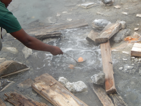
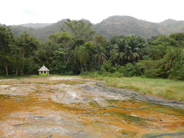

This birders true haven park also known as the newest national park lies in western Uganda covering an area of 220 square kilometres at an altitude of 670-760m above sea level , it lie on the flat valley to the west of the Rwenzori mountain along the border with Democratic Republic of Congo and on the eastern edges of the Congo basin's vast and ancient Ituri forest. The parks ancient bio diverse forest and one of the few African forest to have survived the last ice age. Over 25000 years ago the species of semuliki have been accumulating and the park contains evidence of even older processes. It is as well known for the magnificent "sempaya hot springs' that bubble up from the depth demonstrating powerful subterranean forces that have been shaping the rift valley during the last 14 million years. The park provides natural shelter to 120 mammals including primates such chimpanzees and baboons as well as elephants, antelopes, 435 species of birds, hippos and crocodiles coammon along the semuliki river, 300 species of butterflies, 235 moth species, and the East Africa's only low land tropical forest prone to flooding during the wet season. The park is also known by the four distinct ethnic groups of
people such as the Bamba, Bakonjo, Batuku and Batwa.
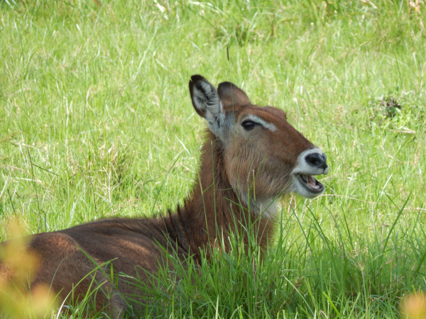
KIDEPO VALLEY NATIONAL PARK
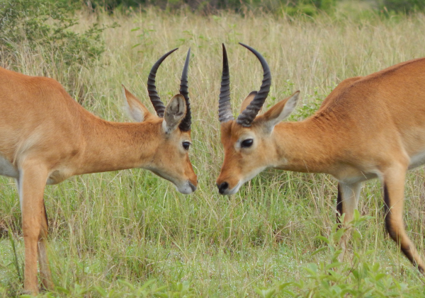
This isolated park covering 1442 square kilometres at an altitude of 914m-2750m above the sea level is found in the country's semi-arid valleys and savannah grasslands in the north east of Uganda with south Sudan in the north west and fee kilometres in the east is the border of Kenya. This home to some of Africa's stunning wilderness is divided across by two river valleys known as kidepo and narus which during the dry season they dry up leaving seasonal oases, pools and wetlands as the only source of water for wildlife making the valleys the prime place for game viewing of the stunning wild life. The park is a home to 476 species of birds with the coammon ostriches, 77 mammals including cheetahs, buffalos, giraffes, lions, elephants, Uganda KOB leaving you with unforgettable experience.
LAKE MBURO NATIONAL PARK
The park is on the smallest national parks in Uganda with 20% of it covered by wetlands. The park covers an area of 370 square kilometres and at altitude 1220m-1828m above sea level in the western region of the country. Lake Mburo around which the park is wrapped is a 50 kilometers long wetland system, its savannah is interspersed with rocky ridges and forested gorges Its a natural home to 350 species of birds making it a stunning spot for birding along the lake and wetlands, 69 animal species including zebras, Buffalos, hyenas, leopards, hippos, and doubles the only national park in Uganda with Impalas
MGAHINGA NATIONAL PARK
This is the country's smallest national park covering an area of 33.7 square kilometres at an altitude of 4127m (highest) above sea level in the extreme South West of Uganda near Rwanda. Despite its size, its part of a much larger virunga conservation area that spans across Rwanda, Democratic Republic of Congo for thousands of square kilometers. It takes its local name from "gahinga' meaning the pile of rudimentary volcanic rocks at the base of the volcanoes. The park with its high elevation was primarily to protect the mountain golliras and the endangered gold monkeys and also double as originally part of the indigenous Batwa (pygimies) territory. The volcano slopes contains various ecosystems with vast bio diversity and their peaks provide a magnificent scenery. It is a natural habitat to 76 mammals including elephants, bush pig, giant forest hog, buffaloes leopards, with over 180 Bird species
MOUNT ELGON NATIONAL PARKS
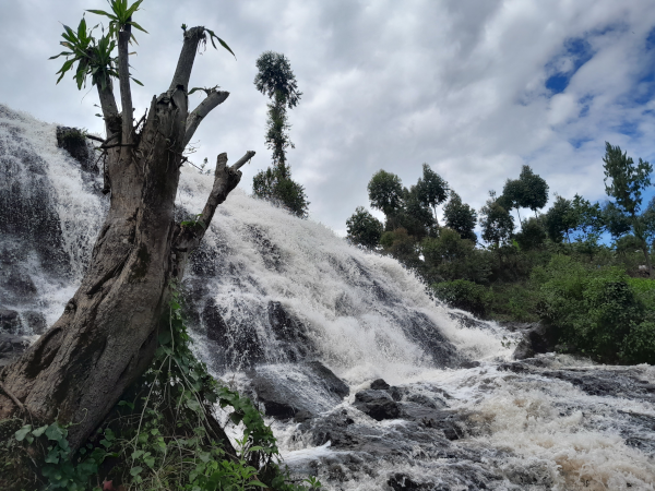

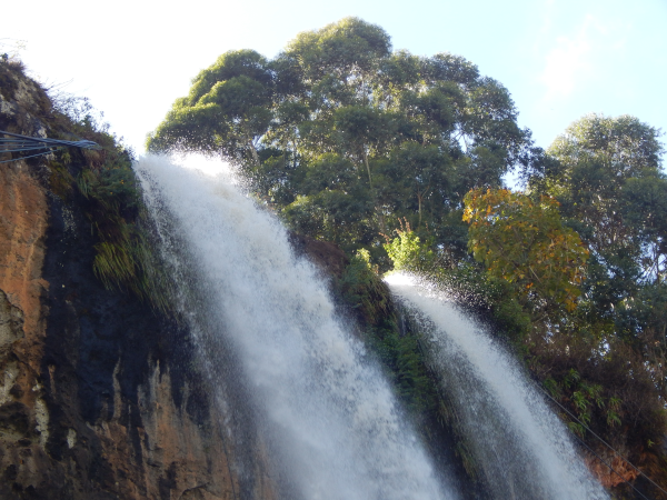
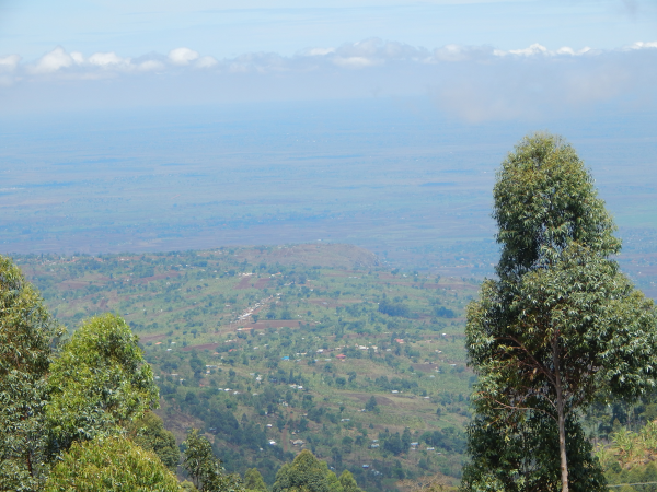
At an altitude of 4321m above sea level and covering an area of 1121 square kilometres in the eastern part of Uganda is a massively eroded remains of an extinct volcano that was once Africa's tallest mountain making it the 4th highest peak in East Africa and 8th in Africa. It is also the oldest and largest solitary volcanic mountain in East Africa measuring 80 kilometres in diameter with a caldera of more than 40 square kilometres. It is a home to a wide variety of climates with flora at the high altitudes, mammals, and 300 bird species including the endangered "Lammer geyer". The parks water falls, gorges, hot springs within the caldera, caves, mountain peaks are the stunning adventures to explore.